| Appalachian Trail Information |
So who's idea was it to make the Appalachian Trail (AT) anyway? The master-mind behind this was Benton MacKaye, who proposed the idea in 1921. With the help of countless volunteers, it became a success in 1937, and it is still known today as one of the most popular trails in the world.
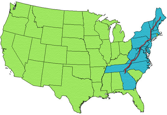
Running through 14 different states at 2,179 miles long, the Appalachian Trail is the nation's longest marked trail! It goes through several National Forests, National Parks and State Parks. The lowest elevation along the trail is near the Trailside Museum and Zoo at Bear Mountain in New York at 124 feet. The highest elevation stands at 6,625 feet in Tennessee on Clingman's Dome.
Since the AT is so long, it is broken down into 5 regions listed below:
Each state listed below has a difficulty rating of the Appalachian Trail.
Difficulty Ratings: On a scale of 1-10, 1 being the easiest/flattest hike, and 10 having the most difficult/roughest terrain.
| Northern New England States - New Hampshire and Maine |
New Hampshire
Lowest elevation: 400 feet
Highest elevation: 6,288 feet
Trail Length: 160.9 miles
Difficulty Rating: 6-10
Maine:
Lowest elevation: 490 feet
Highest elevation: 5,267 feet
Trail Length: 281.4 miles
Difficulty Rating: 3-10
| Southern New England States - Vermont, Massachusetts and Connecticut |
Vermont
Lowest elevation: 400 feet
Highest elevation: 4,010 feet
Trail Length: 149.8 miles
Difficulty Rating: 5-6
Massachusetts
Lowest elevation: 650 feet
Highest elevation: 3,491 feet
Trail Length: 90.2 miles
Difficulty Rating: 3-6
Connecticut
Lowest elevation: 260 feet
Highest elevation: 2,316 feet
Trail Length: 51.6 miles
Difficulty Rating: 4-5
| Mid-Atlantic States - New York, New Jersey, Pennsylvania and Maryland |
New York
Lowest elevation: 124 feet
Highest elevation: 1,433 feet
Trail Length: 88.4 miles
Difficulty Rating: 2-5
New Jersey
Lowest elevation: 350 feet
Highest elevation: 1,685 feet
Trail Length: 72.2 miles
Difficulty Rating: 2-5
Pennsylvania
Lowest elevation: 320 feet
Highest elevation: 2,080 feet
Trail Length: 229.6 miles
Difficulty Rating: 2-4
Maryland
Lowest elevation: 230 feet
Highest elevation: 1,880 feet
Trail Length: 40.9 miles
Difficulty Rating: 2-3
| The Virginia States - West Virginia and Virginia |
West Virginia
Lowest elevation: 265 feet
Highest elevation: 1,200 feet
Trail Length: 4 miles
Difficulty Rating: 2-3
Virginia
Lowest elevation: 265 feet
Highest elevation: 5,500 feet
Trail Length: 550.3 miles
Difficulty Rating: 2-6
| Southern Appalachian States - Tennessee, North Carolina and Georgia |
Tennessee
Lowest elevation: 1,326 feet
Highest elevation: 6,625 feet
Trail Length: 287.9 miles
Difficulty Rating: 5-6
North Carolina
Lowest elevation: 1,725 feet
Highest elevation: 5,498 feet
Trail Length: 95.5 miles
Difficulty Rating: 3-6
Georgia
Lowest elevation: 2,510 feet
Highest elevation: 4,461 feet
Trail Length: 76.4 miles
Difficulty Rating: 6
Difficulty Ratings: On a scale of 1-10, 1 being the easiest/flattest hike, and 10 having the most difficult/roughest terrain. |


