| View all NH 4,000 Footers |
| Mount Adams |
| Mount Bond |
| Bondcliff |
| Mount Bond, West Peak |
| Mount Cabot |
| Cannon Mountain |
| Mount Carrigain |
| Carter Dome |
| Carter, Middle |
| Carter, South |
| Mount Eisenhower |
| Mount Field |
| Mount Flume |
| Mount Galehead |
| Mount Garfield |
| Mount Hale |
| Mount Hancock |
| Mount Hancock, South Peak |
| Mount Isolation |
| Mount Jackson |
| Mount Jefferson |
| Mount Kinsman, North Peak |
| Mount Kinsman, South Peak |
| Mount Lafayette |
| Mount Liberty |
| Mount Lincoln |
| Mount Madison |
| Mount Monroe |
| Mount Moosilauke |
| Mount Moriah |
| Mount Osceola |
| Mount Osceola, East Peak |
| Owl's Head |
| Mount Passaconway |
| Mount Pierce |
| Mount Tecumseh |
| Mount Tom |
| Mount Tripyramid, Middle Peak |
| Mount Tripyramid, North Peak |
| Mount Twin, North Peak |
| Mount Twin, South Peak |
| Mount Washington |
| Mount Waumbek |
| Mount Whiteface |
| Mount Wildcat, A Peak |
| Mount Wildcat, D Peak |
| Mount Willey |
| Zealand Mountain |
| NH Mountain Ranges/ Areas ↓ |
| View all NH Mountain Ranges |
| Baldface-Royce Range |
| Carter-Moriah Range |
| Dartmouth Range |
| Franconia Range |
| Kinsman Range |
| Mahoosuc Range |
| Northern Ranges |
| Ossipee Mountains |
| Pemigewasset Wilderness |
| Pilot Range |
| Pliny Range |
| Presidential Range |
| Sandwich Range |
| Twin Range |
| Wapack Range |
| Willey Range |
|
|
Hike Owl's Head |
| |
| On this page: Information | Trail maps | View Photos | Driving Directions |
| |
Elevation: 4,025 feet (1,227 meters)
Prominence:  825 feet (251 meters) 825 feet (251 meters)
Location: Franconia, NH
Range: Pemigewasset Wilderness
Coordinates: 44°8'40" North 71°36'18" West
Rating: Moderate
Features: Brooks
Distance of highlighted hike below: 18.2 miles
|
 |
Owls Head is a 4,025 foot mountain in the White Mountains. It is part of the Pemigewasset Wilderness along with Mount Hancock, South Hancock Mountain and Mount Carrigain.
It is one of the only NH 48 4,000 footers without a maintained trail to the summit. (But so many hikers have been there, that the trail is obvious.) There are no views from the wooded summit, but you can catch some great spots with views along the Owl's Head Path looking to Mount Lafayette, Mount Lincoln and Little Haystack Mountain.
In 2005, it was discovered that the summit was actually a lower peak of the mountain. The true summit is now classified as being 0.2 miles north of that. (If you hiked the mountain before 2005, or hearing of this news, your original hike to the false summit, still counts!) The summit area of Owl's Head is a bit tricky with multiple narrow trails that can seem like a maze, but they all lead to the summit cairn.
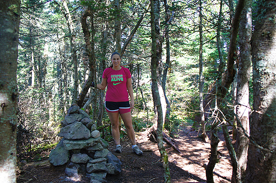
Cairn on the summit of Owl's Head on September 1, 2012.
|
| |
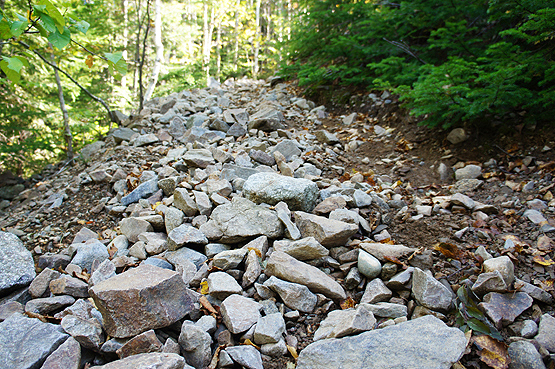
The beginning of the Owl's Head Slide trail. Let the loose rocks begin! On September 1, 2012.
This is how half of the Owl's Head (Slide) Path is: Very loose rocks = very dangerous!
|
| |
| Owl's Head Trail Maps - Directions from the Lincoln Woods Visitor's Center |
Top |
The map below shows how to get to the summit of Owl's Head Mountain from the Lincoln Woods Visitor's Center.
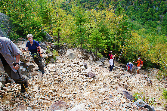
Hike along the Lincoln Woods Trail up past the Black Pond Trail and the Franconia Falls Trail. Continue straight and bear left onto the Franconia Brook Trail. Hike for 1.7 miles until you reach a junction with the Lincoln Brook Trail. Take the left onto Lincoln Brook Trail and hike for 3.4 miles until you reach the Owl's Head Path trail on your right. The summit is 1.1 miles up! (This 1.1 miles is very loose rocks and incredibly steep, so be careful and take your time. Average hiker time takes about 2 hours just to get up this slide.) Once you find the summit cairn, retrace your steps back to the Lincoln Woods Parking lot.
Many people choose to mountain bike the first 3ish miles of the Lincoln Woods Trail, to knock off some time, because the trail is flat. But be sure to watch out for old railroad planks from the old East Branch and Lincoln Railroad, that stick out of the ground. This was the largest logging railroad in New England. The last train to ride the rails was in 1948. You will see signs of the old railroad for the majority of your hike. On your way back down from Owl's Head, just pick up your bike and cruise down to the parking lot! (BUT if your goal is to complete the NH 48 4,000 Footers and get the long-awaited patch for your success, rules say NO BIKES.)
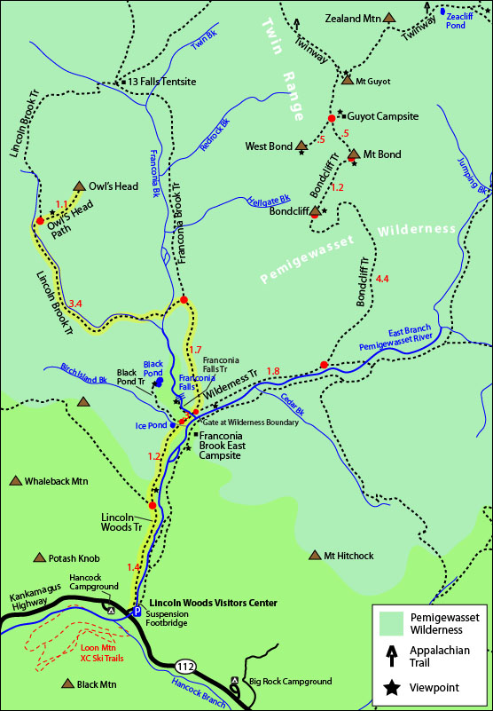
Click to download PDF Trail Map of Owl's Head
Alternative Hiking Route
This is how to get to the summit of Owl's Head Mountain from the Galehead Hut. (So this hike generally requires an overnight by staying at this hut, the 13 Falls Tent site or the Garfield Ridge Campsite.)
From the Galehead Hut, take the Twin Brook Trail for 2.7 miles until you reach a 4-way intersection. (On the right and left will be the Franconia Brook Trail.) Stay straight onto the Lincoln Brook Trail for 3.5 miles until you reach a trail on the left called Owl's Head Path. Go up that path, and you will reach the summit of Owl's Head in 1.1 miles.
To get back to the Galehead Hut, retrace your steps back the 7.3 miles.
 |
 |
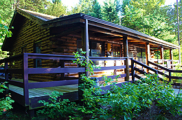
Lincoln Woods Visitor Center. Begin your 18.2
mile journey here! |
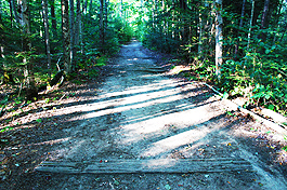
How most of the trail looks: flat, old railroad beds (If you take the Lincoln Woods Trail) |
|
| |
|
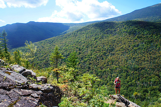
An outlook point on the Owl's Head Path on September 1, 2012.
|
| Owl's Head Driving Directions |
Top |
These are driving directions to the Lincoln Woods Visitor's Center Parking Lot:
Take exit 32 off I-93 onto the Kancamagus Highway, Route 112. Continue for 5 miles until you reach the Lincoln Woods Visitor Center on the left. (It is just shortly after the Hancock Campground on the right.)
Directions to the alternative route up to Owl's Head, via the Garfield Trail head parking lot:
Take exit 35 off I-93 to merge onto the route 3 / Daniel Webster Highway. Drive 4.8 miles and turn right onto Gale River Loop Road. Parking is by the Garfield Trail trail head |
|
On this page: Information | Trail maps | View Photos | Driving Directions | Top
|
|
|
|
|
|
|
|
|
|
|
|
|
|
| |
| |
|
| New Hampshire 4,000 Footers |
Vermont + Maine 4,000 Footers |
Other Hiking Lists / Patches |
New England Mountain Ranges |
Stay Involved in New England |
New Hampshire
Mount Adams
Mount Bond
Bondcliff
Mount Bond, West Peak
Mount Cabot
Cannon Mountain
Mount Carrigain
Carter Dome
Carter, Middle
Carter, South
Mount Eisenhower
Mount Field
Mount Flume
Mount Galehead
Mount Garfield
Mount Hale
Mount Hancock
Mount Hancock, South Peak
Mount Isolation
Mount Jackson
Mount Jefferson
Mount Kinsman, North Peak
Mount Kinsman, South Peak
Mount Lafayette
Mount Liberty
Mount Lincoln
Mount Madison
Mount Monroe
Mount Moosilauke
Mount Moriah
Mount Osceola
Mount Osceola, East Peak
Owl's Head
Mount Passaconway
Mount Pierce
Mount Tecumseh
Mount Tom
Mount Tripyramid, Middle Peak
Mount Tripyramid, North Peak
Mount Twin, North Peak
Mount Twin, South Peak
Mount Washington
Mount Waumbek
Mount Whiteface
Mount Wildcat, A Peak
Mount Wildcat, D Peak
Mount Willey
Zealand Mountain |
Vermont
Mount Abraham
Camel's Hump
Mount Ellen
Killington Peak
Mount Mansfield
Maine
Mount Abraham
Mount Bigelow, Avery Peak
Mount Bigelow, West Peak
Crocker Mountain
Crocker Mountain, South
Mount Katahdin, Baxter Peak
Mount Katahdin, Hamlin Peak
North Brother Mountain
Old Speck Mountain
Mount Redington
Saddleback Mountain
Saddleback Mountain, The Horn
Spaulding Mountain
Sugarloaf Mountain |
NH 4,000 footers
NH 4,000 footers in Winter
New England 4,000 footers
NE 4,000 footers in Winter
NH Hundred Highest
New England Fifty Finest
52 With a view
Trailwrights 72 summit club
New England Hundred highest
NE Hundred highest in Winter
Northeast 111
48x12 "The Grid"
Red Lining
Belknap Range
LRCT / Castle in the Clouds
NH Fire Tower Quest
Hike by - Alphabetically
Hike by - Elevation
Hike by - Prominence
Hike by - Mountain Range |
Ranges in New Hampshire
View all NH mountain ranges
Baldface-Royce Range
Carter-Moriah Range
Dartmouth Range
Franconia Range
Kinsman Range
Mahoosuc
Range
Ossipee Mountains
Northern Ranges
Pemigewasset Wilderness
Pilot Range
Pliny Range
Presidential Range
Sandwich Range
Twin Range
Wapack Range
Western White Mountains
Willey Range
Ranges in Maine
View all ME mountain ranges
Baxter State Park
High Peaks
Bigelow Range
Eastern White Mountains
Ranges in Vermont
Green Mountains
Other VT mountain ranges |
NH Waterfalls
NH AMC Huts
Hiker's store |
New England 4,000 Footers | NH 4,000 Footers | VT 4,000 Footers | ME 4,000 Footers | Hiking Lists & Patches | Hiker's Store | Contact by email
© www.4000footers.com 2015. All rights reserved. We are not affiliated with the AMC or the AMC Four Thousand Footer Club |
|
|


