|
|
|
Hike Mount Mansfield |
| |
| On this page: Information | Trail maps | View Photos | Driving Directions |
| |
| Mount mansfield Information |
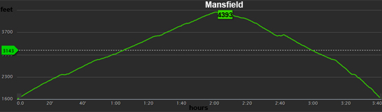
Elevation: 4,393 feet (1,339 meters)
Prominence:  3,633 feet (1,107 meters) 3,633 feet (1,107 meters)
Location: Underhill, VT (Chittenden and Lamoille County)
Range: Green Mountains
Coordinates: 44°32'38" North 72°48'52" West
Rating: Moderate/Difficult
Features: Long Trail, Peak bag, Taft Lodge, Eagle Pass, Mount Mansfield Ski Area, Lake of the Clouds close-by, Underhill State Park
Distance of highlighted hike below: 4.8 miles
|
 |
Mount Mansfield is a 4,393 foot mountain in the Green Mountains of Vermont. It is the tallest peak in the state of Vermont. Mount Mansfield has many secondary peaks forming the ridge line including The Nose, Forehead and the Adam's Apple. They are all named as body parts because some say the ridge line of Mansfield looks like a face. These features are more distinct when viewed from the East.
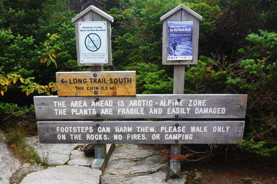
Mount Mansfield along with Camel's Hump and Mount Abraham are the only 3 mountains in Vermont where alpine tundra survived the ice age. Mount Mansfield has 200 acres of alpine tundra.
The mountain has many uses. The Nose is home to transmitter towers used for radio and TV stations. The Long Trail traverses the summit of Mount Mansfield. Winter skiing and snowboarding occurs on the East side of the mountain at Stowe Mountain Resort.
|
| |
| Mount mansfield Trail Maps - Directions from the parking lot to the summit |
Top |
The map below shows how to get to the summit of Mount Mansfield (The Chin) from the Long Trail Parking Lot on Route 108.
From the parking lot head up the Long Trail for 2 miles. You will pass the Taft Lodge, an overnight spot for hikers/campers. Continue on the Long Trail by staying left. (Right will take you to the Adam's Apple on the Hell Brook Trail.) Hike for 0.3 miles and you will reach the summit of Mount Mansfield, AKA The Chin. To get back to the parking lot, retrace your steps the way you came.
Rollover the map below to see a close-up view
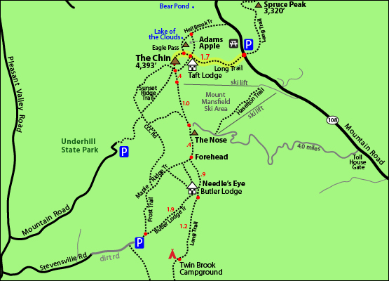
Click to download PDF Trail Map of Mount Mansfield
|
| |
|
| Mount mansfield Photos |
Top |
|
Along the Long Trail on August 28, 2014
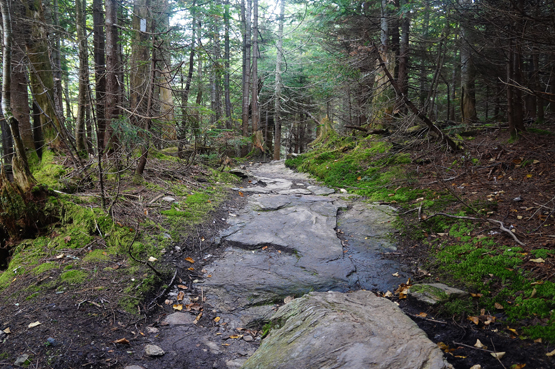
Along the Long Trail on August 28, 2014
Almost at the Chin, AKA the summit of Mansfield on August 28, 2014.

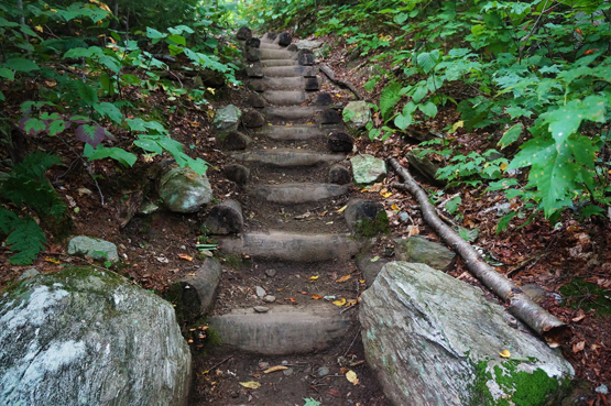
Difficult part of the Long Trail August 28, 2014.
Along the Long Trail on August 28, 2014
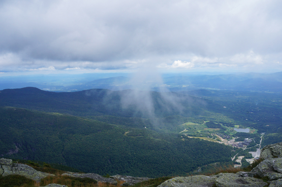
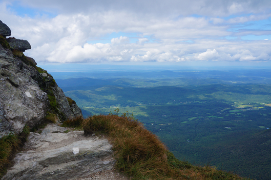
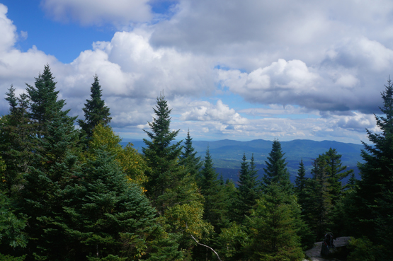
Views from the summit of Mount Mansfield / The Chin on August 28, 2014.
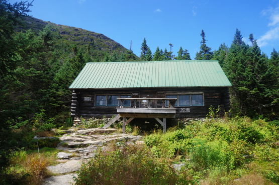
Taft Lodge off the Long Trail with Mount Mansfield in the background.
Views from the Taft Lodge off the Long Trail on August 28, 2014.
|
| Mount mansfield Driving Directions |
Top |
The parking lot for the above hike is located on Route 108 in Underhill, Vermont. From I-89 North, take exit 10 for VT-100 South towards Waterbury US-2. Drive 0.3 miles and turn right VT-100 North. Drive 9.5 miles and turn left onto VT-108 N/Mountain Road. Drive roughly 9 miles and the parking lot will be on the right side of the road. The trail starts on the left side of the road.
|
|
On this page: Information | Trail maps | View Photos | Driving Directions | Top
|
|
|
|
|
|
|
|
|
|
| |
|
|
|
|
|
| |
| New Hampshire 4,000 Footers |
Vermont + Maine 4,000 Footers |
Other Hiking Lists / Patches |
New England Mountain Ranges |
Stay Involved in New England |
New Hampshire
Mount Adams
Mount Bond
Bondcliff
Mount Bond, West Peak
Mount Cabot
Cannon Mountain
Mount Carrigain
Carter Dome
Carter, Middle
Carter, South
Mount Eisenhower
Mount Field
Mount Flume
Mount Galehead
Mount Garfield
Mount Hale
Mount Hancock
Mount Hancock, South Peak
Mount Isolation
Mount Jackson
Mount Jefferson
Mount Kinsman, North Peak
Mount Kinsman, South Peak
Mount Lafayette
Mount Liberty
Mount Lincoln
Mount Madison
Mount Monroe
Mount Moosilauke
Mount Moriah
Mount Osceola
Mount Osceola, East Peak
Owl's Head
Mount Passaconway
Mount Pierce
Mount Tecumseh
Mount Tom
Mount Tripyramid, Middle Peak
Mount Tripyramid, North Peak
Mount Twin, North Peak
Mount Twin, South Peak
Mount Washington
Mount Waumbek
Mount Whiteface
Mount Wildcat, A Peak
Mount Wildcat, D Peak
Mount Willey
Zealand Mountain |
Vermont
Mount Abraham
Camel's Hump
Mount Ellen
Killington Peak
Mount Mansfield
Maine
Mount Abraham
Mount Bigelow, Avery Peak
Mount Bigelow, West Peak
Crocker Mountain
Crocker Mountain, South
Mount Katahdin, Baxter Peak
Mount Katahdin, Hamlin Peak
North Brother Mountain
Old Speck Mountain
Mount Redington
Saddleback Mountain
Saddleback Mountain, The Horn
Spaulding Mountain
Sugarloaf Mountain |
NH 4,000 footers
NH 4,000 footers in Winter
New England 4,000 footers
NE 4,000 footers in Winter
NH Hundred Highest
New England Fifty Finest
52 With a view
Trailwrights 72 summit club
New England Hundred highest
NE Hundred highest in Winter
Northeast 111
48x12 "The Grid"
Red Lining
Belknap Range
LRCT / Castle in the Clouds
NH Fire Tower Quest
Hike by - Alphabetically
Hike by - Elevation
Hike by - Prominence
Hike by - Mountain Range |
Ranges in New Hampshire
View all NH mountain ranges
Baldface-Royce Range
Carter-Moriah Range
Dartmouth Range
Franconia Range
Kinsman Range
Mahoosuc
Range
Ossipee Mountains
Northern Ranges
Pemigewasset Wilderness
Pilot Range
Pliny Range
Presidential Range
Sandwich Range
Twin Range
Wapack Range
Western White Mountains
Willey Range
Ranges in Maine
View all ME mountain ranges
Baxter State Park
High Peaks
Bigelow Range
Eastern White Mountains
Ranges in Vermont
Green Mountains
Other VT mountain ranges |
NH Waterfalls
NH AMC Huts
Hiker's store |
New England 4,000 Footers | NH 4,000 Footers | VT 4,000 Footers | ME 4,000 Footers | Hiking Lists & Patches | Hiker's Store | Contact by email
© www.4000footers.com 2015. All rights reserved. We are not affiliated with the AMC or the AMC Four Thousand Footer Club |
|
|