| View all NH 4,000 Footers |
| Mount Adams |
| Mount Bond |
| Bondcliff |
| Mount Bond, West Peak |
| Mount Cabot |
| Cannon Mountain |
| Mount Carrigain |
| Carter Dome |
| Carter, Middle |
| Carter, South |
| Mount Eisenhower |
| Mount Field |
| Mount Flume |
| Mount Galehead |
| Mount Garfield |
| Mount Hale |
| Mount Hancock |
| Mount Hancock, South Peak |
| Mount Isolation |
| Mount Jackson |
| Mount Jefferson |
| Mount Kinsman, North Peak |
| Mount Kinsman, South Peak |
| Mount Lafayette |
| Mount Liberty |
| Mount Lincoln |
| Mount Madison |
| Mount Monroe |
| Mount Moosilauke |
| Mount Moriah |
| Mount Osceola |
| Mount Osceola, East Peak |
| Owl's Head |
| Mount Passaconway |
| Mount Pierce |
| Mount Tecumseh |
| Mount Tom |
| Mount Tripyramid, Middle Peak |
| Mount Tripyramid, North Peak |
| Mount Twin, North Peak |
| Mount Twin, South Peak |
| Mount Washington |
| Mount Waumbek |
| Mount Whiteface |
| Mount Wildcat, A Peak |
| Mount Wildcat, D Peak |
| Mount Willey |
| Zealand Mountain |
| NH Mountain Ranges/ Areas ↓ |
| View all NH Mountain Ranges |
| Baldface-Royce Range |
| Carter-Moriah Range |
| Dartmouth Range |
| Franconia Range |
| Kinsman Range |
| Mahoosuc Range |
| Northern Ranges |
| Ossipee Mountains |
| Pemigewasset Wilderness |
| Pilot Range |
| Pliny Range |
| Presidential Range |
| Sandwich Range |
| Twin Range |
| Wapack Range |
| Willey Range |
|
|
Hike Mount Whiteface |
| |
| On this page: Information | Trail maps | View Photos | Driving Directions |
| |
| Mount Whiteface Information |
Elevation: 4,019 feet (1,225 meters)
Prominence:  591 feet (180 meters) 591 feet (180 meters)
Location: Wonalancet, NH, Grafton County, NH
Range: Sandwich Range
Coordinates: 43°56'02" North 71°24'21" West
Rating: Moderate
Features: Brook,
Limited Summit Views, Lookout spots,
Peak bag
Distance of highlighted hike below: 11.4 miles with
Mt. Passaconway (or hike just Whiteface at 6.8 miles)
|
 |
Mount Whiteface is a 4,042 foot mountain in the White Mountains. It is sandwiched between Mount Tripyramid, and Mount Passaconaway.
It is situated in the Sandwich Range of the White Mountains along with 6 other 4,000 footer mountains: Mount Osceola, East Osceola Mountain, Middle Tripyramid Mountain, North Tripyramid Mountain, Mount Tecumseh and Mount Passaconway. There are 5 other mountains in this mountain range that are not 4,000 footers: Mount Chocorua, Mount Kancamagus, Mount Paugus, The Sleepers, Sandwich Mountain
The summit of Mount Whiteface lies on the Rollins Trail roughly 0.3 miles north of the top of a massive granite cliff, for which the mountain is named after. The summit is heavily wooded with no summit sign.
Mount Whiteface lies within the watershed of the Saco River, which reaches the Gulf of Maine at Saco, Maine. The south side of Whiteface is drained by the Whiteface River, then into the Cold River, Bearcamp River, Ossipee River, and the Saco River. The east side is drained by the Wonalancet River, then into Swift River, and Bearcamp River. The north side is drained by Downes Brook, then into another Swift River, and the Saco River.
|
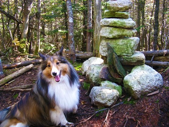
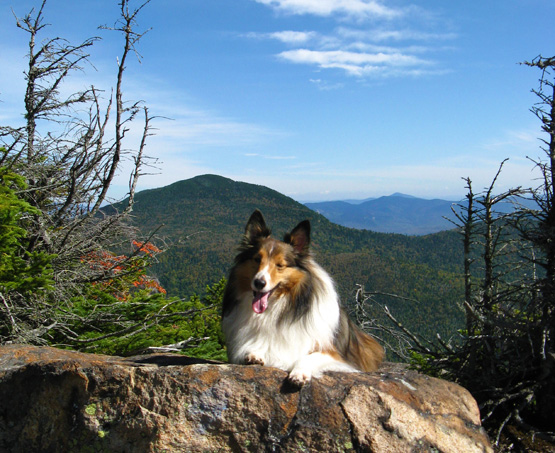
Photo of a hiker-dog who successfully made it to the summit of Mount Whiteface on 9/26/2011 |
|
| Mount Whiteface Trail Maps - Directions from the parking lot to the summit |
Top |
The map below shows how to get to the summit of Mount Whiteface as well as Mount Passaconway. Parts of this hike are on private property, so please be respectful when hiking on someone else's land. They do allow hikers to pass through with ease.
Begin by walking out from the parking lot onto Ferncroft Road by taking a right. Walk to the end of the road where the Dicey's Mill Trail begins. Hike up for 1.6 miles, passing a gate fairly close to the beginning of the trail, until you reach an intersection. Turn right onto the Tom Wiggin Trail and continue for 1.1 miles where you will meet up with the Blueberry Ledge Trail. Turn right and continue for roughly 0.8 miles until you reach the summit of Mount Whiteface (staying right on the trail even when you pass the McCrillis Trail and the Kate Sleeper Trail, both on the left).
After you enjoy the summit of Whiteface, continue along the Rollins Trail for 2.2 miles where you will meet back up with the Dicey's Mill Trail on the right. Stay left and continue up for 0.9 miles until you reach the summit of Mount Passaconway.
There are several trails to take back down to the parking lot, but here is our suggestion: Hike down the 0.9 miles you just climbed up to get to the Dicey's Mill Trail and Rollins Trail junction. Take the Dicey's Mill trail down for 3.4 miles until you reach the end of Ferncroft Road, and turn left back into the parking lot.
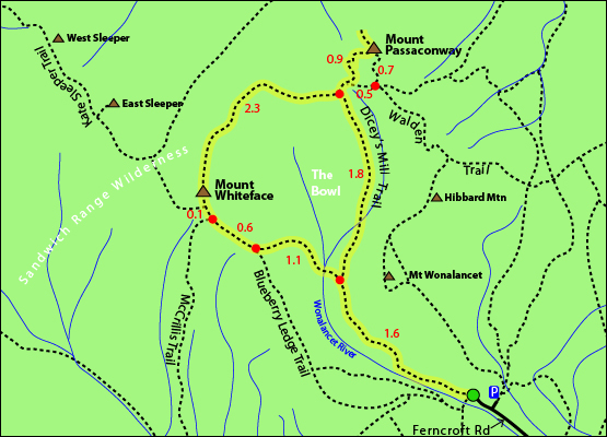
Click to download PDF Trail Map of Mount Whiteface and Mount Passaconway
|
| |
|
| |
| Mount Whiteface Photos |
Top |
|
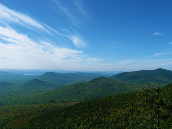
Views from along the Rollins Trail on 9/26/2011
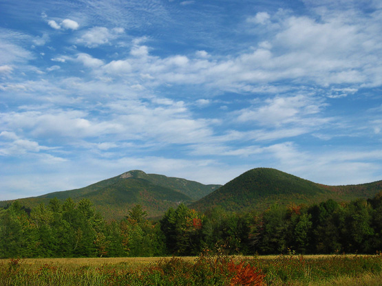
View from the road before the Whiteface / Passaconway loop hike on 9/26/2012
Lookout spot up to Mount Whiteface on
9/26/2012
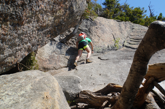
Difficult scramble on the Blueberry Ledge Trail on May 24, 2015.
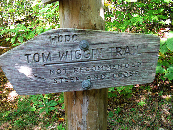
Tom Wiggin Trail (not recommended steep and loose) trail sign on 9/26/2012
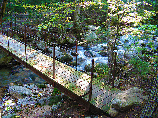
Photo near the beginning/end of the hike crossing the river on 9/26/2012
|
| Mount Whiteface Driving Directions |
Top |
The parking lot for this hike is located on Ferncroft Road in Wonalancet, NH.
From the South:
Take exit 24 off I-93 where you will end up on US-3/NH-25 towards Ashland/Holderness. Turn right onto Route 25 / E/US-3 / S/Daniel Webster Highway and follow for 4.4 miles. Turn left onto route 113 / Squam Lake Road and follow for 11.7 miles. Turn left onto route 113 / E/Maple Street and follow for 3.7 miles. Continue to follow route 113A W for 6.7 miles. Instead of turning onto the same route (113A) at a sharp 90 degree angle, you will stay straight onto Ferncroft Road. The parking lot is down the road on the right.
From the North (Berlin, NH area):
Follow route 16 South until it meets up with route 113 (Deer Hill / Silver Lake Road), where you will take a right onto route 113 West (Chocrua Road). Drive 2.9 miles and turn right on route 113A East and continue for 5.6 miles. Ferncroft Road will be on your right side. Drive down Ferncroft Road until you see a turn on the right side for a parking lot.
|
|
On this page: Information | Trail maps | View Photos | Driving Directions | Top
|
|
|
|
|
|
|
|
|
|
|
|
|
| |
| |
|
| New Hampshire 4,000 Footers |
Vermont + Maine 4,000 Footers |
Other Hiking Lists / Patches |
New England Mountain Ranges |
Stay Involved in New England |
New Hampshire
Mount Adams
Mount Bond
Bondcliff
Mount Bond, West Peak
Mount Cabot
Cannon Mountain
Mount Carrigain
Carter Dome
Carter, Middle
Carter, South
Mount Eisenhower
Mount Field
Mount Flume
Mount Galehead
Mount Garfield
Mount Hale
Mount Hancock
Mount Hancock, South Peak
Mount Isolation
Mount Jackson
Mount Jefferson
Mount Kinsman, North Peak
Mount Kinsman, South Peak
Mount Lafayette
Mount Liberty
Mount Lincoln
Mount Madison
Mount Monroe
Mount Moosilauke
Mount Moriah
Mount Osceola
Mount Osceola, East Peak
Owl's Head
Mount Passaconway
Mount Pierce
Mount Tecumseh
Mount Tom
Mount Tripyramid, Middle Peak
Mount Tripyramid, North Peak
Mount Twin, North Peak
Mount Twin, South Peak
Mount Washington
Mount Waumbek
Mount Whiteface
Mount Wildcat, A Peak
Mount Wildcat, D Peak
Mount Willey
Zealand Mountain |
Vermont
Mount Abraham
Camel's Hump
Mount Ellen
Killington Peak
Mount Mansfield
Maine
Mount Abraham
Mount Bigelow, Avery Peak
Mount Bigelow, West Peak
Crocker Mountain
Crocker Mountain, South
Mount Katahdin, Baxter Peak
Mount Katahdin, Hamlin Peak
North Brother Mountain
Old Speck Mountain
Mount Redington
Saddleback Mountain
Saddleback Mountain, The Horn
Spaulding Mountain
Sugarloaf Mountain |
NH 4,000 footers
NH 4,000 footers in Winter
New England 4,000 footers
NE 4,000 footers in Winter
NH Hundred Highest
New England Fifty Finest
52 With a view
Trailwrights 72 summit club
New England Hundred highest
NE Hundred highest in Winter
Northeast 111
48x12 "The Grid"
Red Lining
Belknap Range
LRCT / Castle in the Clouds
NH Fire Tower Quest
Hike by - Alphabetically
Hike by - Elevation
Hike by - Prominence
Hike by - Mountain Range |
Ranges in New Hampshire
View all NH mountain ranges
Baldface-Royce Range
Carter-Moriah Range
Dartmouth Range
Franconia Range
Kinsman Range
Mahoosuc
Range
Ossipee Mountains
Northern Ranges
Pemigewasset Wilderness
Pilot Range
Pliny Range
Presidential Range
Sandwich Range
Twin Range
Wapack Range
Western White Mountains
Willey Range
Ranges in Maine
View all ME mountain ranges
Baxter State Park
High Peaks
Bigelow Range
Eastern White Mountains
Ranges in Vermont
Green Mountains
Other VT mountain ranges |
NH Waterfalls
NH AMC Huts
Hiker's store |
New England 4,000 Footers | NH 4,000 Footers | VT 4,000 Footers | ME 4,000 Footers | Hiking Lists & Patches | Hiker's Store | Contact by email
© www.4000footers.com 2015. All rights reserved. We are not affiliated with the AMC or the AMC Four Thousand Footer Club |
|
|


