| Mount Monadnock Information |
Elevation: 3,165 feet (965 meters)
Prominence:  2,150 feet (660 meters) 2,150 feet (660 meters)
Location: Jaffrey and Dublin, New Hampshire, Cheshire County
Coordinates: 42°51'39" North 72°6'29" West
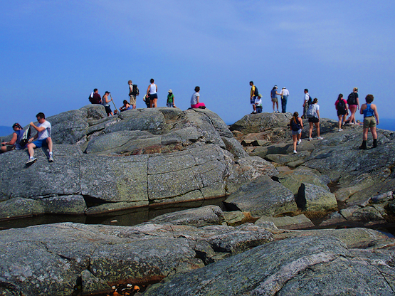
Features: 360° summit views, Monadnock Reservation,
Distance of highlighted hike below: 3 Treeless Zone
|
 |
Mount Monadnock also known as Grand Monadnock as is a 3,165 foot mountain in NH. It is the most prominent mountain in Southern New Hampshire and also the highest point in Cheshire County because is is almost 1,000 feet taller than any other mountain within 30 miles of it. This mountain is heavily hiked and is ranked the most hiked mountain in the world! (Some argue it is Mount Fuji, because the numbers are so close.)
American geologists use the term "monadnock" to mean any isolated mountain formed formed from the exposure of a harder rock as a result of the erosion of a softer rock that once surrounded it.
The summit is open and bare mostly due to early 1800s settlers who set fires to clear the slopes for pasture. Between 1810 and 1820, fire was set on Mount Monadnock again, but this time because they thought wolves were living in the blown-down trees.
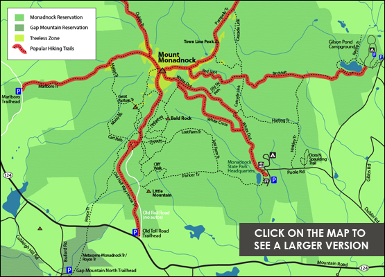
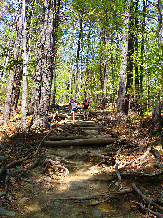
There are many trail choices leading up to the summit. Some of the main trails include the White Dot Trail, White Cross Trail, Birchtoft Trail, Red Spot Trail, Pumpelly Trail, Dublin Trail, Marlboro Trail, Old Half Way House Trail and the Royce Trail. The Metacomet-Monadnock Trail (110 miles long) and the Monadnock-Sunapee Greenway (50 miles) both also ascend the mountain.
The earliest recorded ascent of Mount Monadnock took place in 1725 by captain Samuel Willard and 14 rangers who worked under him and used the summit as a lookout place for Native Americans.
|
| Mount Monadnock Driving Directions |
Top |
Driving directions to Monadnock State Park - The start of the White Dot / White Cross Trail
If you have a GPS, you can enter 116 Poole Road, Jaffrey, New Hampshire. (it is the end of Poole Road). These are directions to the park's headquarters. The White Dot Trail starts here.
Parking is on a small side road off Poole Road near the end of Poole Road on the left side.
From Route 124 West (Turnpike Road) turn right onto Dublin Road. Drive 1.3 miles and turn left onto Poole Road.
|